ADK 46: Donaldson and Emmons
Region: Adirondacks, High Peaks Wilderness; Seward Range via Coreys Road October 23, 2021 | near Tupper Lake, NYThe background: The Seward Range includes 3 mountains: Seward, Donaldson, and Emmons. You might be wondering about the title of this hike, and why I technically didn’t climb Seward to complete the range. The truth is this was my second time back in a 6-week timeframe. I had attempted to hike nearby Seymour along with the 3 mountains in the Seward Range (so a total of 4) in one shot on a summer-like day in September; however, the loop and terrain proved to be challenging, daylight was running out, and a family friend was expecting me before dark. All of this combined, there was not enough time to tackle Emmons without exiting in pitch black (which in theory would have been fine since we all had headlamps; but not something we wanted to do.) I’ve learned the art of orphaning peaks this year, so gracefully left the range in September promising dear Emmons I would return shortly to embrace her muddy remoteness in full force and revisit my friend Donaldson, which is on the way.
So, I did just that. And brought my partner (now husband) along for the ride. I only waited until after we were in the car leaving to share that we had just summited one of the most remote peaks in the ADK wilderness. It was glorious.
And as to be expected…terribly muddy.
Getting there: For reference, this is about a 45 minute drive from Lake Placid. Head west on route NY-86 towards Saranac Lake for about 6 miles. Depending what time it is, if you need to make a stop, I would recommend one of the gas stations, or there is a Dunkin’ Donuts or McDonald’s once you reach Saranac Lake (but definitely check the hours since they aren’t 24/7.) Make a left onto River Street, which will turn into route 3, for 13 miles (towards Tupper Lake.) You’ll make a left onto Corey’s Road (there will be a trail sign indicating you are at the correct road) which you will drive down for 5.5 miles. You will first pass a trailhead for Raquette Falls on your right - this is not the parking lot for the Seward Range in 3-season weather. Continue down the road; the Seward parking lot will be on your right with a sign indicating it’s for Seward Mountain - see photo below (if you drive too far down the road, you will hit a dead end, as it is private property.) We parked on the side of the road because the lot was already full (but I’m sure this isn’t preferred…)
While sections of the road are not perfectly paved, your car shouldn’t have any major issues in 3-season weather (my front wheel Jetta made it just fine.) You most likely won’t have cell phone reception as you drive further down the road, so have your hiking route ready ahead of time, as you will be navigating unmarked trails for most of the day.
Note: the last stretch of road leading to the trailhead parking lot closes sometime in December (I heard the gate goes down) for the winter season, so you will be adding on additional mileage in the winter.
The route: ~ 14 miles(22.52km) out-and-back. Starting from the Seward trailhead: Blueberry trail to Calkins Brook trail to Seward Mountain Trail; up to Donaldson, continuing onto Emmons.
If you are looking to complete the entire range (adding on Seward) you can hike out-and-back as described above and add on Seward from the split with Donaldson, or complete as a loop (this is definitely more challenging and will add significant elevation gain/loss to your already long day. Not impossible, but know you will be putting in lots of work consistently throughout the day!)
There are also designated spaces to camp and a few lean-tos if you wanted to break up the mountains into 2 or more days and camp overnight. Note that the lean-tos can fill up fast in peak season, so have a backup plan in mind.
Completion time: slightly under 10 hours car-to-car, including a combined 45 minutes to an hour of purposeful breaks/stops.
I am a moderately cautious hiker, so rarely include my time since everyone is vastly different, but shared this instance so you can get a sense of the day and if you want to factor in adding Seward.
The hike: I was used to 3am wake-up calls all summer, so it was a treat for my alarm to go off at 5:30am for this one. Since the sun did not rise until later at this point in the season, we decided to arrive around 7:30am, giving us the full day for Mission Emmons. This allowed us a quick stop at Dunkin’ for our ride over to the trailhead. To my surprise, the lot was already full (I mean, it was a Saturday in autumn… so I shouldn’t have been too surprised!) so we parked on the road, geared up, and signed in the trail register to start our day.
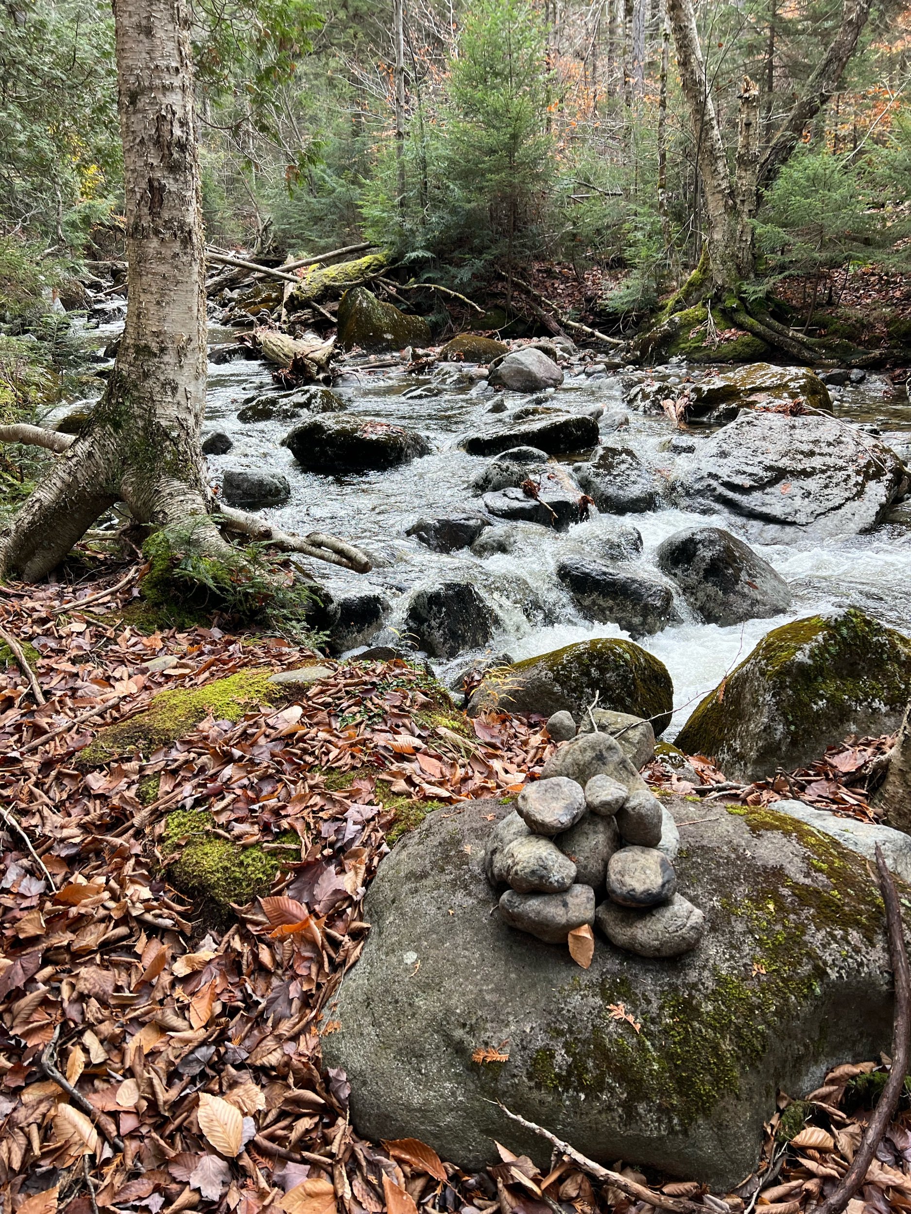
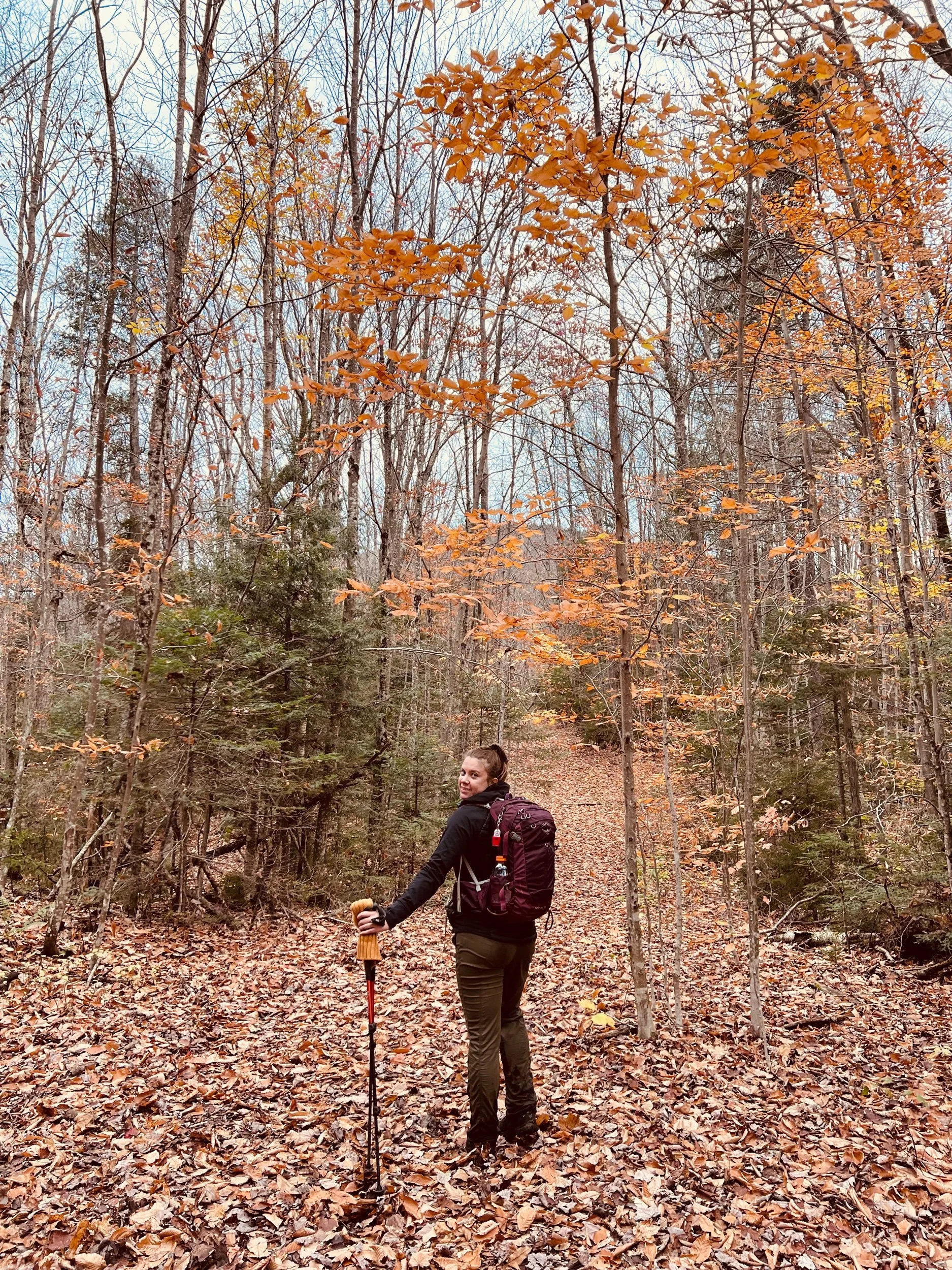
We kept a good pace down Blueberry, to Calkins, passing a few hikers until we reached the junction (it will be obvious) where we would pick up the herd path. We took a quick break then made the left to keep going towards Donaldson. It was a bit tricky at times to follow the path because of all the leaves covering the trail this time of year; however, the path should feel worn in and not a bushwhack, ever. If you think you’re off course, you probably are. Also note, you will have to cross a brook - there will be a cairn, so be on the lookout for it. Once you start to gain elevation, the trail is much more obvious in my opinion, and you should have no trouble following the worn in herd path. You will also encounter lots and lots of mud - have your gaiters on and/ or a pair of spare socks (or 2) should you want to change on your descent.
After one quick break and keeping a steady pace on this brisk October day, we finally reached the unmarked split for Seward and Donaldson. Left will take you over to Seward, so be sure you remain going straight for Donaldson and Emmons. There will be one larger-sized (but not terrible) rock scramble up to Donaldson. If you want to stop here first, you will see a small path to take you up to the rock ledge where you’ll have a bit of a view. We decided to keep going and stop on our way back since I had been there on my last Seward Range trek.
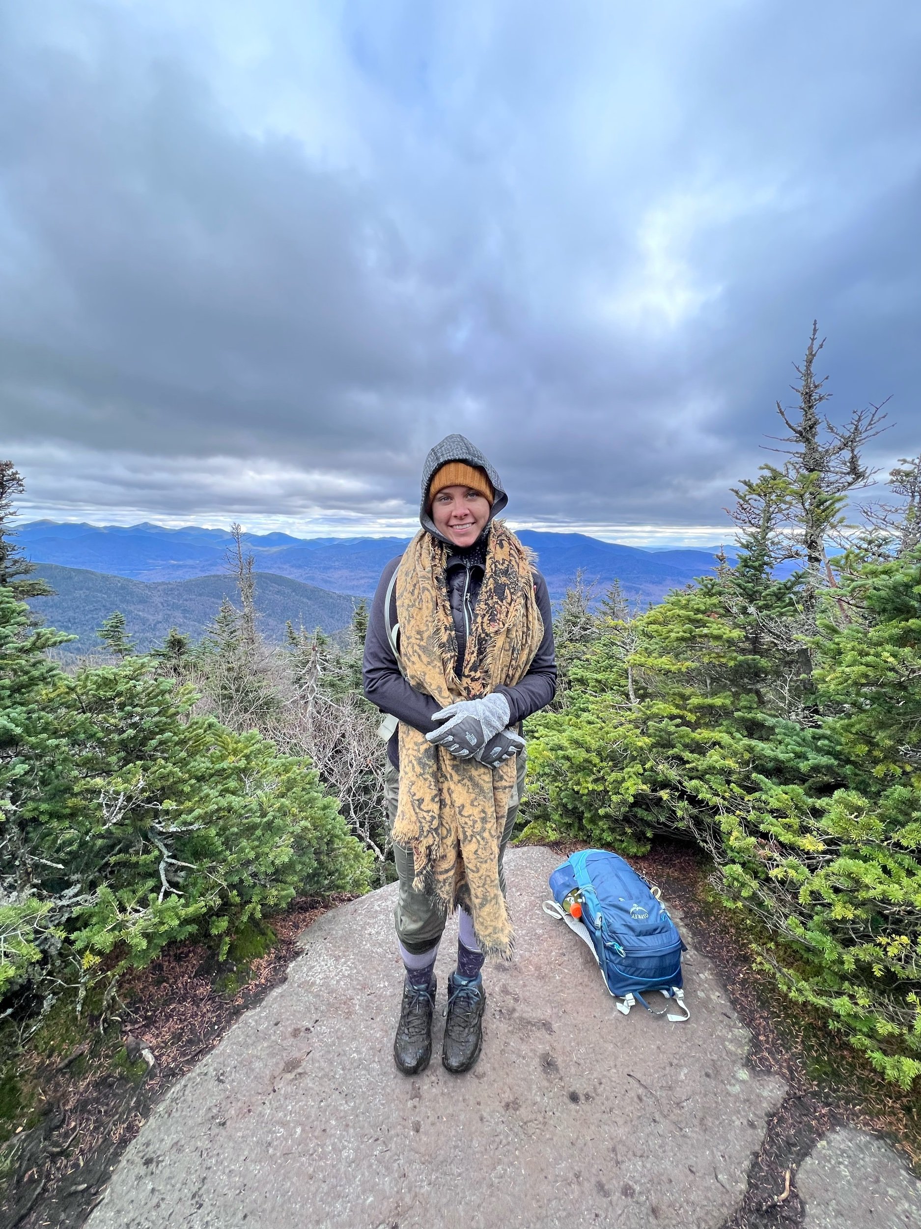
Now the fun would begin. After bypassing Donaldson, we headed out to the most western and remote of the 46 High Peaks. Although it’s only about a mile over to Emmons, you will be encountering some of the muddiest areas of the park (at least I thought…) to make your way to the summit. This seemed to drag on - the only thing keeping me inspired at this point was the cute dogs that we kept crossing paths with! The trail will be rather straightforward to follow, but you won’t be able to avoid the mud unless there is snow covering. After what felt like nearly forever (are we there yet??!), the summit sign appeared. There will be no major view at the summit sign itself, but you’ll have some nice quick views as you make your way over (so make sure to look up from the mud once in a while!)
And then we got to experience it one last time by making the trek back to Donaldson. A liiittle more mud wouldn’t hurt us…
We retraced our steps, descending Emmons and reascending Donaldson for a well-deserved sock change, lunch, and a final check-in to get ready for the descent.
The hike out was uneventful in the best way possible. A word of advice, be mindful of the trail as you approach the Calkins Brook to make sure you stay on course.
By 5:45pm, we were signed out, eager to change out of our muddy boots and get back into town for dinner.
A successful day checking off High Peak number 44 for me and another wonderfully muddy, adventurous day in the mountains!
Concluding notes: This is a long day that will test your mental strength. While there are a few larger rock scrambles, most of the challenge will lie in the navigation and the length of this hike. For the majority of the trail, you don’t have the guardrails of knowing you are on a marked trail. The trail will be mostly straight forward and is definitely not a bushwhack by any means; however, during the fall season, some of the leaf covering may make it more challenging to stay on trail (as we encountered.) Be extra conscious of your surroundings and listen to your intuition if you feel like you are not on the trail. There is no harm in stopping to reassess your surroundings and map. No section should feel like you are paving the way (although remote, these definitely have seen an uptick in traffic lately for aspiring 46rs!)
Despite no “killer summit views” with an eh reputation, I still believe this is a beautifully rugged hike with its own unique experience. If you are working towards your 46, do not fear this hike; rather, embrace the adventure and quiet you will find in these Western High Peak mountains.
I will return one day. But until then…
PS: dinner afterwards was at Blue Line Brewery. Would recommend if you’re heading that way (as always, check operating hours ahead of time.)