ADK 46: The Santanoni Range
Region: Adirondacks, High Peaks WildernessJuly 10, 2021 | near Newcomb, NYThe background: These three remote mountains are on every aspiring 46er’s radar – whether they are thrilled about it or not. So now it was time for me to find out what the fuss was all about. In addition to the fact that they are herd paths and unmaintained trails, some things I had heard repeatedly, were mud, “the bog” mud, long, limited views, muddy, mud, out of the way…sounds like fun stuff, right?!
Despite how tough I heard this trio of mountains was, including the stretch to and from Couchsachraga particularly (which is not even technically 4,000 feet but gets to keep its name on the list due to tradition) I was still excited to take on the challenge. My hiking partner and I had planned to tackle Cliff this day but decided the day before to instead hike the Santanoni Range in a day. This would be her second round so I was happy she was down for this (looong) adventure, yet again.
Getting there: This trail will start off of Upper Works Road in Newcomb (but NOT the same lot as if you were to go to Marshall, Redfield, Cliff, etc.) From I-87, take exit 29 and make a left onto Blue Ridge Road for about 17 miles. Then, turn right onto Tahawus Road for 6.4 miles and make the left onto Upper Works Road, where in about 2 miles, you will turn left onto Santanoni Road – drive in here, and you will see the designated parking area. If you reach a large lot with a fence at the end of the road, you went too far (this is about another mile or so down the road. There is also another lot for Mount Adams and Allen – which is on the right before the main lot at the dead end – your cue for the Santanoni’s is that this lot is on the left when you’re driving down the road northbound.) There is no fee to park, and there are a decent number of spaces by ADK standards, but you’ll want to start this one early (or later in the afternoon if you’ll be camping in the backcountry.) Your vehicle should have no issues in 3-season weather getting down the road and to the lot.
For reference: this is about 1 hour + 15 minutes from the Lake George region, and 1 hour + 30 minutes from the Lake Placid area (of course will vary based on exact location.)
Plan accordingly: you will not have any (AT&T) cell service in the lot but may have some once you start to ascend the peaks. As I always say, do not rely on it.
The hike: ~ 17 miles (27.35km) of mostly unmarked/unmaintained trails (each peak has a summit sign.) Significant elevation gain (to the tune of 4,600+ feet / 1402m…) and loss is also a common theme throughout the day.
Clockwise starting from Santanoni Road down the Bradley Pond Trail: first, up the Santanoni Express to Santanoni, down to Times Square, out and back to Couchsachraga, over to Herald Square, out-and-back to Panther Peak, down Panther Brook herd path to Bradley Pond trail, completing the loop back to the trailhead (WHOA.)
Santanoni Peak (when I say SANTA you say NONI…)
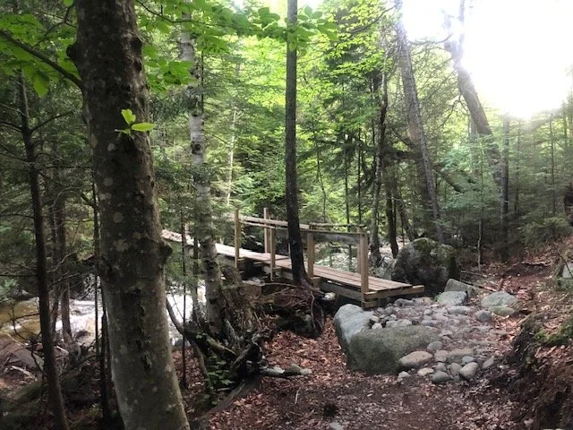
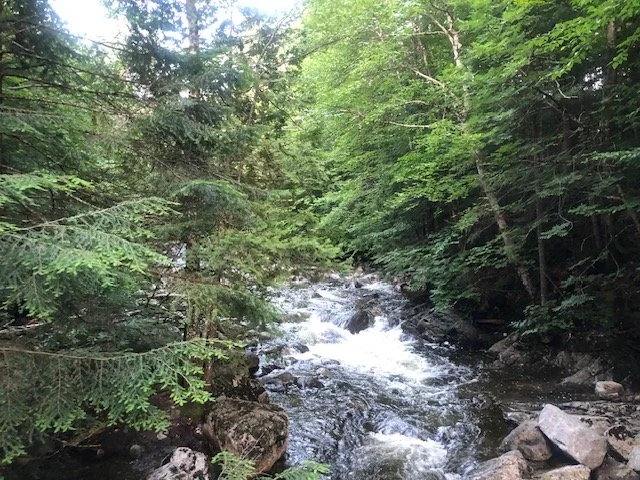
We hit Santanoni Road at 5:15AM, ready for the long summer day ahead of us. Fortunately, we would have lots of daylight on our side which would be needed for this long trek into the wilderness. We passed through the gate, signed in, and were well on our way down the road (it’s a road… but with rolling hills!) for the mile and a half-ish until our next turn. After the road walk to warm up our legs, we soon approached the arrow sign directing us to turn right onto the Bradley Pond Trail. Our road-walk now officially turned to trail terrain. After another mile and half or so of mild terrain with the soundtrack of Santanoni Brook to our left (after crossing the bridge over it), we saw the large cairn. This meant we would start to officially begin our loop and ascend the Santanoni Express to our first peak of the day, Santanoni. We took a quick break and then veered left past the cairn, where the fun would begin as well as the unmaintained/unmarked trails. We would only be reunited with this intersection much, much later in the day for our walk out.
We were enjoying catching up and relatively mild terrain (this would soon change) when we were crossing the brook, and suddenly, a man came up behind us. We smelled something and realized he was now running through the water (yep) with a cigarette in his hand… I thought it was just too early and I was seeing things, but my hiking buddy saw it too. He greeted us hurriedly in between smoking and running, soon flying past us out of sight. It was for sure one of the oddest encounters I’ve ever had on the trail. Thankfully, we would not run into him again on this hike (or ever, to date.)
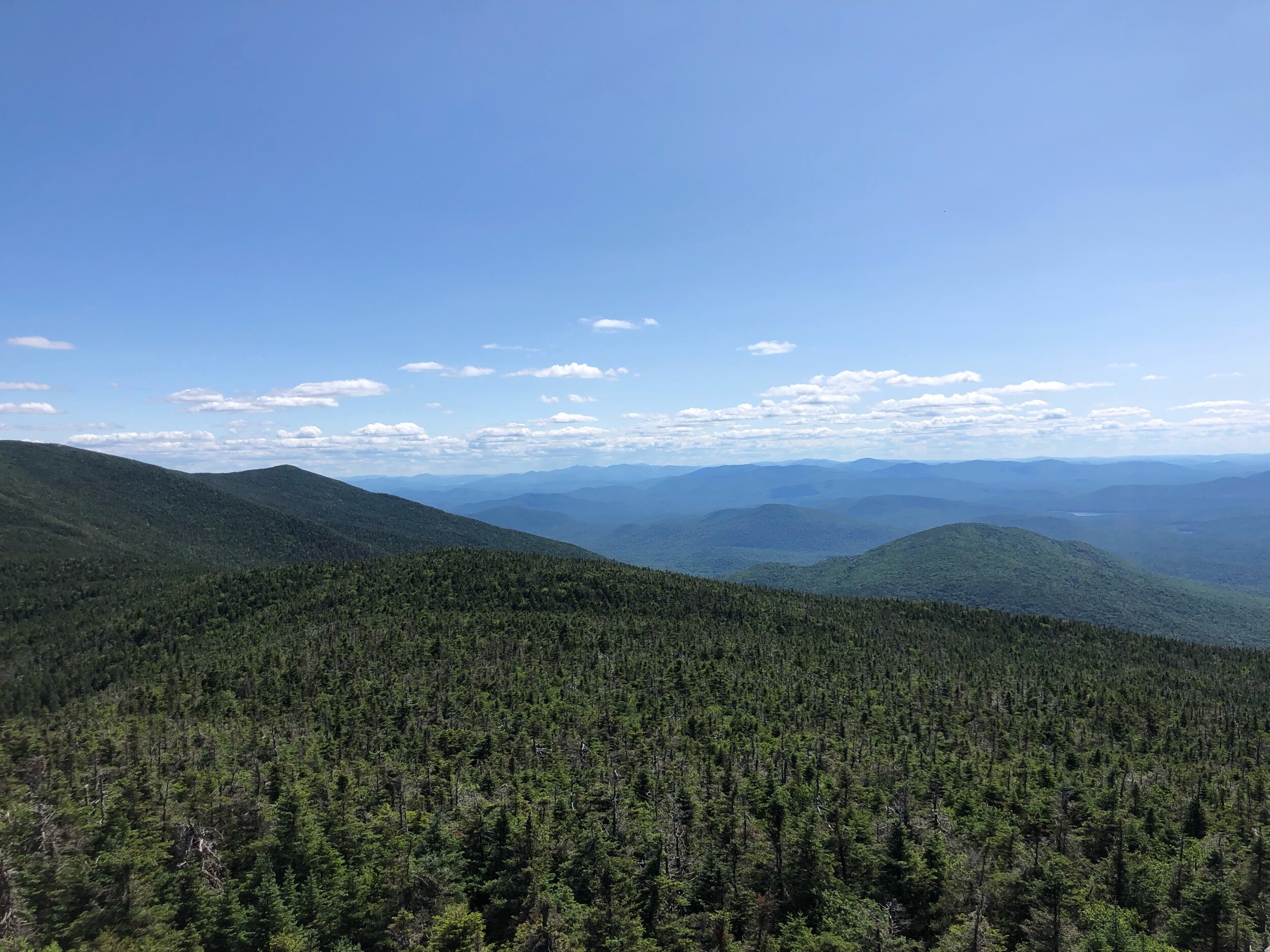
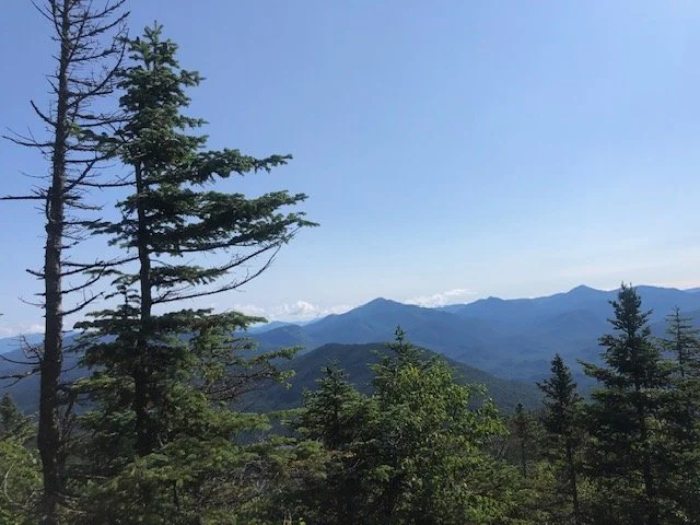
After we laughed off the strange encounter, we were soon wandering through a lush meadow, when we realized we had to turn back and find the trail again. Once back on trail, we were now encountering the real “mud” that everyone had been talking about. And the steepness – it got reeeal steep. After falling into bogs, mud, and being careful with our footing on the slippery rocks and slides, we were finally getting above treeline. We took a few moments to look back and see what a gorgeous day it was shaping up to be. We were committed to remaining hydrated knowing the summer heat would get to us.
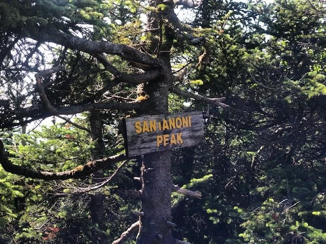
We soon reached an unmarked junction where we would come back to in order to reach Couchsachraga. But first, we walked over to the summit sign for Santanoni. At 9:30AM, we made it!! We ran into an older couple, who asked us if we had VT plates on our cars- to which my partner replied she did- and they informed us that a car with VT plates had left “all 4 of their windows open.” Well…it was too late now to go back, but she was pretty sure it was her car! Whelp… I guess we would find out for sure at the end of the day. The only way to find out was to keep moving…
After some photo snapping and a quick sandwich break, we hiked back to the junction, this time, continuing on leftwards for our descent to an intersection called “Times Square.” There is no sign here, but this is the unmarked area where the “trails” of the range intersect. After a careful but relatively steady pace off Santanoni, we found ourselves at Times Square, greeting a few other hikers passing through. After a pause and another quick break, it was time for me to go meet the infamous “Couch Bog.”
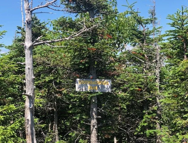
Couchsachraga Peak
(challenge: sing boggy oggy oggy oggy oggy to the tune of “Body” by Megan Thee Stallion.)
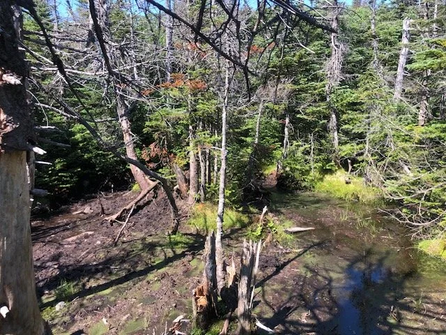
As I mentioned earlier in this post, Couchsachraga (Cook-sa-crah-ga) was mis-measured back in the day when the 46 High Peaks were established. It is technically below the 4K threshold (along with 3 others) but is still lovingly included on the list. We were now descending the area from Times Square, and into the thick of the mud – so much more mud than I’ve ever encountered in the High Peaks before. The heat of the day was getting to us, so we stopped often to hydrate and catch our breath. We made it across the infamous bog unscathed! We did not fall in (neither there nor on the way back) !! what more could a girl ask for… After what seemed like forever wading through mud, climbing, and praying for a break, we made it to our tree-covered destination with no view at 12:50PM. We celebrated by trying to take photos with the sign (some hikers were napping on the rock next to the sign?!) and devouring snacks. Now, we just had to simply (lol) retrace our steps back to Times Square…and would have to not only descent Couch, but also climb back up to the intersection. I had no idea this was part of the route – but yes, you will descend Couch, and re-climb up to the intersection. Ahhhh…
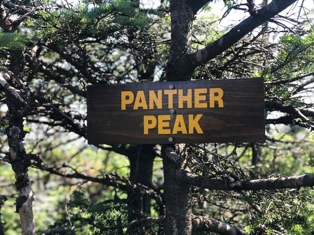
Panther Peak (last hoorah)
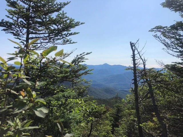
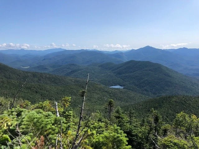
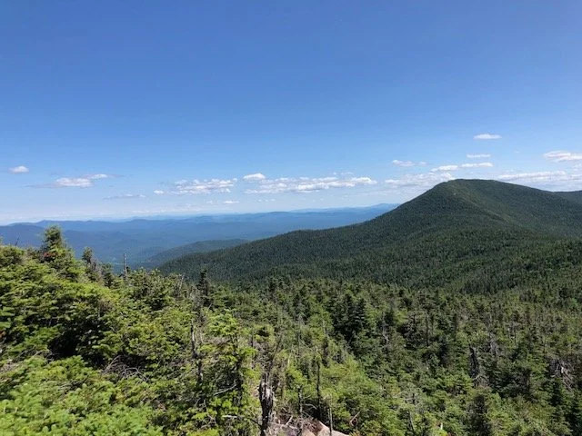
The heat continued to try to break us – but we were staying hydrated and fed, doing our best to stay on top of it. We were so used to the mud now, we were sailing in autopilot. One peak left and then it would be time to go home. We made it back to Times Square (I’ve never been happier) and now turned left to our next stop, Herald Square, where we would take the short (0.2 miles or so) trail to Panther. I honestly thought this part, navigation wise, was a bit tricky – there are a few different herd paths and we were debating which one it was. Finally, we did see the P carved on a tree, and found the correct path to the summit. More bogs, more mud, more fun… we saw a few more hikers who we’ve been seeing all day, when all of a sudden, my buddy realized her phone (new one, too) was gone. We decided it was best for me to keep going to the summit a short distance away, while she retraced her steps on the trail to Panther, since we knew she had it in her possession not too long ago. Since we were near the summit, cell service was strong, so I called her, hoping this might help in the search. I was soon above tree line, appreciating the first expansive view from a summit all day. I snapped a selfie with the Panther Peak sign and then saw her running towards me – the phone was retrieved! An angel hiker left it on a rock when they found it. It was all good. Without much further hesitation at the summit, we began our descent back to Herald Square, where we would now start the tedious descent back to the Bradley Pond Trail out.
By this point, we were undoubtedly fatigued and beat from a substantial mix of mud and sun. But we kept as steady pace as possible down the Panther Brook herd path, knowing dinner was in our near future. In the back of my head, I reminded myself that all peaks were successfully summitted. I was thrilled, but also beyond exhausted. I knew how much work we still had to do to get to the car…
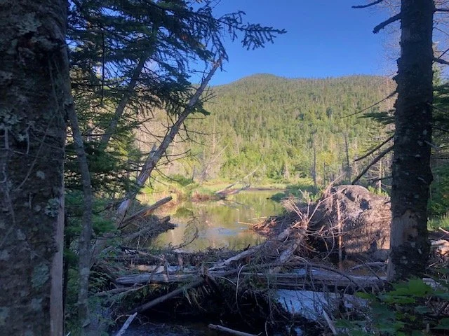
After what seemed like a good eternity, we were finally nearing Bradley Pond, where we saw hikers coming in to camp and spend the night. When you reach the end of the pond, you will turn right to continue on the marked trail, taking you back to the cairn from the morning at the Santanoni Express junction. We debated filtering water but realized we would have enough to make it back safely without stopping and potentially losing daylight. The rest is a bit of a blur, but we kept in good spirits until we reached the cairn, then the beginning of Santanoni Road. This was the final push to the end.
And this, my friends, was one of the most challenging stretches of hikes I’ve ever had on a high peak trail.
After some motivational words and whatever encouragement we could muster up to say to each other, it finally appeared: the parking lot. After 14 hours on trail fighting the mental and physical battles ‘til our very last step, we signed ourselves out at the trail register, got out of our muddy boots as best we could, and drove straight to the Stewart’s in Keene for some much-deserved replenishment a la pizza and snacks (and we even saw one of our “trail friends” too!!)
(and PS: the car windows WERE open, but it all ended just fine!)
Concluding notes and my thoughts:
This is a very long day, no matter how you slice and dice it, even if you are camping – and both physically and mentally draining. As much as I love solo hikes, I would recommend hiking this with a buddy or two. I was so grateful for the company (and I say this as someone who enjoys solo hiking.) As you just read, the walk out Santanoni Road was one of the most mentally challenging moments I’ve had in a while. But we did it together, safely.
While this is a long day, it is not impossible. I would highly recommend bringing not one, but two pairs of spare socks, perhaps even spare pants, and a little bag to put all your muddy socks in. Unless you make the trek in the snowy winter months, I don’t think there is any way to avoid being nearly covered in mud (or if there is, let me know!!) Gaiters would also be very helpful on this trail, for sure. Mental toughness is going to be key here; if you are not feeling it when you get to the trailhead, I would suggest turning around, and/or driving down the road to hike Mount Adams (a shorter trail with a fire tower, but still includes “high peaks terrain.”) This is not to deter you – but rather, to encourage you to tackle this range when you’re really in it, enjoying and embracing the challenges.
Although this is a given, I will outline it here, too: ensure you plan and prepare appropriately in terms of gear and supplies. The weather can change in an instant, and due to the length of this hike, you may be out longer than anticipated. Double check that your headlamp and spare batteries (or extra headlamp) are in your pack before you get on trail.
Overall, we had an amazing (albeit long) day in the High Peaks. And I will even say that I look forward to revisiting this range in the future (yes, that includes you, Couch…)
Happy (muddy) High Peaks hiking!