Moxham Mountain
October 23, 2020 | Minerva, NY
The background: It was a Friday, and I had driven up at my usual 5-9AM timeframe, arriving in Bolton Landing for the start of my week-long working fall-cation. My “summer Friday” work hours were still in effect, so my plan was to wrap up work at the condo, unpack, and then head out for an afternoon hike. It was also an unseasonably warm fall day – to the tune of 68 degrees. There was no way I wasn’t going to get out and enjoy this weather, as I thrive in the warmer temperatures. My initial plan was to hike Mount Adams, but my gut told me to find something a little closer and less challenging for my solo afternoon rendezvous – I was also exhausted from the early morning drive upstate. I love hiking in the Lake George area, but wanted to go explore another mountain where I hadn’t been to before. I keep a running list in the notes section of my phone and realized Moxham was about a 40-minute drive away. So Moxham it was!
Getting there: The trailhead on Google maps is accurate if you type in Moxham Mountain Trailhead. From I-87 South, you’ll take exit 26 towards Pottersville/Minerva. You’ll turn right onto Olmstedville Road for about 6 miles, and eventually turn right onto AP Morse Highway. After about 2.5 miles, you’ll turn left onto Town Shed Road. You’ll continue on this road for about 2 miles, which turn into 14th Road, to the trailhead. A small parking area will be on your left, right after the gravel road ends. Important note: the last few yards to the trailhead are on unpaved road, and the road dips as you approach the parking area. My Jetta did fine, but just be cautious – I’m not sure how it’s in winter and if it’s plowed. As usual, cell service will be sparse at the trailhead. Plan your route ahead of time.
The hike: This is a moderate 5.4 mile out and back hike. The trail is marked and clear to follow, with no major watch-outs or challenging sections. Although you will be gaining elevation, the terrain never feels too steep or unmanageable.
I arrived at the trailhead around 1:30PM with a few other cars in the lot. I couldn’t blame them – it was still the most amazing autumn day. I knew this would be short-lived, as the forecast called for rain and colder temperatures the next few days, so I was determined to make the most of this afternoon. I had light layers on, but even then, it was too much for this given day!
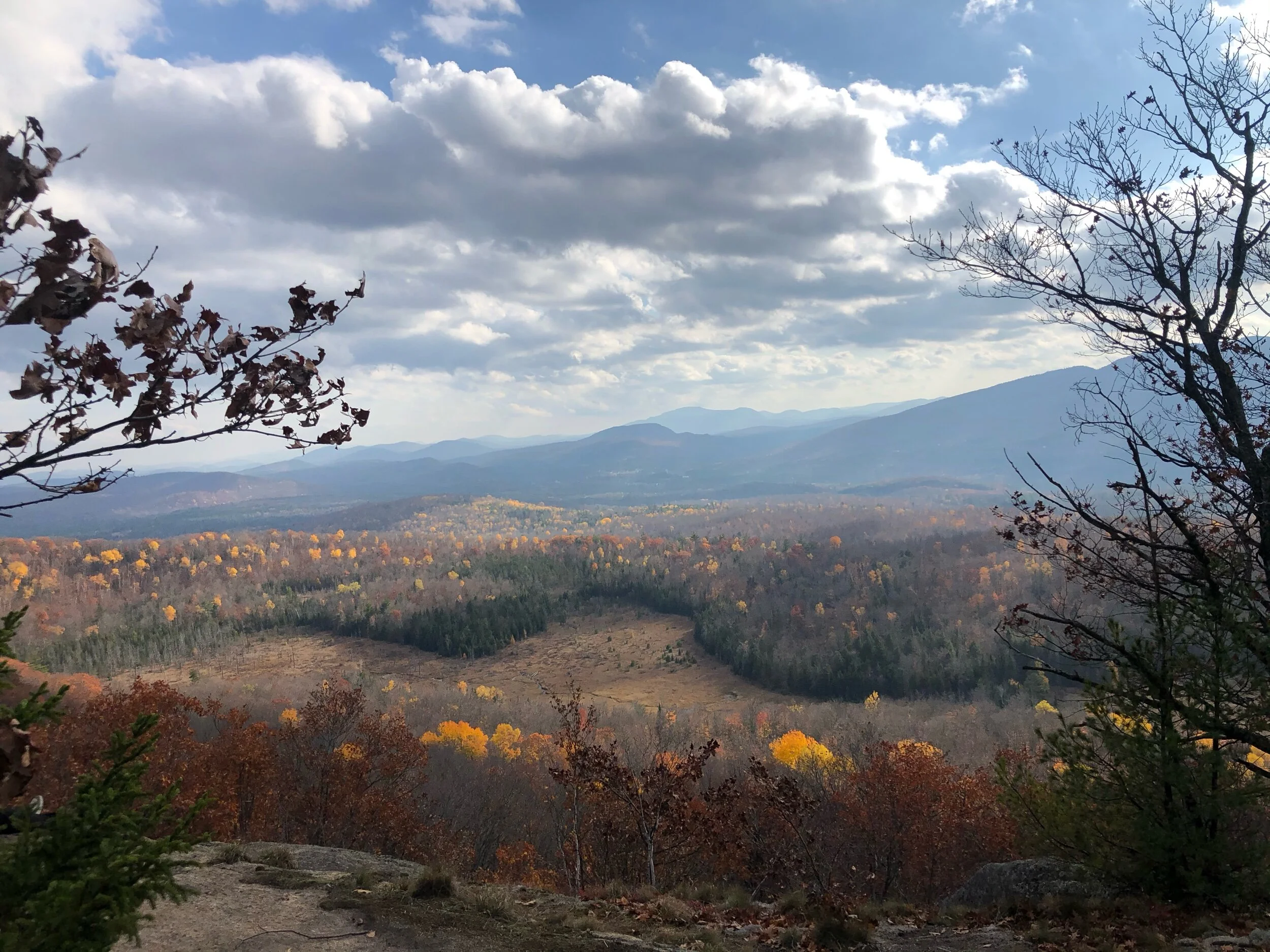
The trail starts out on the left side of the road, where you’ll walk in a few yards and sign into the register. I thoroughly enjoyed this first section, which served to me as a short “warm-up” by the way of a flat, serene, forest walk. I had missed most of peak foliage, but the leaves were still captivating and charming to me. I kept going until I finally started to see the views that everyone had talked of. As you keep going past the “teaser” view, you’ll eventually cross a small stream to keep going towards the summit. I knew that I would eventually reach the ridge, where I would see the summit in my sight, but wow! I was not expecting it to be as awesome as it was. I took a short break once I reached the first of the ridge section, as I could see some bright yellow leaves still lingering from the season.
As you make your way up the ridge, you’ll be able to stop and soak in all the beauty of the Vanderwhacker Mountain Wild Forest. I passed a few smaller groups, but never felt it was overcrowded or unpeaceful. I was now gaining more elevation as I approached the summit viewing area. And it was spectacular! I stopped here to take some photos and hydrate. Like many of my hikes this season, I had the summit to myself yet again. You know I love hiking with others, but there is something so invigorating yet soothing about being alone with mother nature, even for a few moments. A few others eventually joined me on the summit, as we all took in the sights and sun on this unexpected day. I left the summit (with hesitation, as I was loving my time here) and made my way back, as my goal was to be back in town before sunset. The hike back the way I came was uneventful; a few more groups were hiking in, as everyone wanted to soak in what could be one of the last warmer days of the season.
Concluding notes: This mountain is a true gem in the Adirondacks. It is both a family and dog friendly hike, with no intense nor steep sections to tackle. You can truly make a day of it or complete it in a few short hours. You can’t go wrong with whichever way you choose to enjoy this trail.
My recommendation for an ideal day and what you can pair this hike with:
OK Slip Falls Trail, about 25 minutes west towards Indian Lake. This is a hike to a waterfall, not a summit- but still one of the greatest in the region nonetheless.
Goodnow Mountain Fire Tower, another shorter trail, about 30 minutes north in Newcomb.
If this is your only hike of the day, you could stop in North Creek (about 15 minutes south) and explore the Gore Mountain area, or grab food at one of the local restaurants (I like Sarah’s or Chrissy’s for breakfast, and Beck’s Tavern, barVino, or Basil and Wick’s for dinner.)