
ADK 46: Tabletop, Marcy, Skylight & Gray
Region: Adirondacks High Peaks Wilderness
August 11, 2020 | Lake Placid, NY
The background: If I had to pick a day in the High Peaks Wilderness that changed me and my perspective of the mountains forever, this is it. Mother Nature showed no mercy on me this day; it didn’t matter that I was (mostly) buttoned up and prepared as a solo hiker. I studied the route for weeks, read reports, listened to other hikers’ advice, etc. While all of this is great and can help to mitigate risk, there were events that occurred that I simply could not predict nor change. But when you’re in it, you’re in it, and the only way through is through. So that’s exactly what I did – I kept going and made it through. My original plan was to hike Marcy, Skylight and Gray, and add in Tabletop before the 3 if I was making good time in the beginning – which I ultimately decided to do. On this journey, I was able to check off 4 more high peaks on my quest to become an ADK 46’er. I was also able to learn more than I ever had on the trail before.
Getting there: You’ll park at the Adirondack Loj just outside of Lake Placid. The lot will be to your left once you see the attendant station. As you can imagine, parking fills up fast and early on weekends. When I visited, the parking fee was $7 for ADK Mountain Club members and $10 for non-members. If no attendant is at the booth, leave the amount in the envelope in the box and take the parking tag to your car. You will not have any cell service at this point until you start to gain elevation miles away from the lot. The road is not an issue for vehicles in 3-season weather.
There is a restroom here and you can also rent certain equipment during business hours. Be sure to check out their website for all that they offer.
IF the lot is full, you can drive back up the road and park at South Meadows. You can approach from this direction for this hike, as well (but NOT for Street/Nye or Jo.) There is no fee here.
My solo route starting from the Adirondack Loj:
An important note: I don’t really recommend this, as there are other ways to enjoy the peaks.
Van Hoevenberg Trail ->Tabletop Mountain Trail to Tabletop Mountain.
Backtrack down Tabletop Mountain Trail, continuing on Van Hoevenberg Trail to Mount Marcy.
Mount Marcy trail -> Skylight Trail to Mount Skylight.
Back down the Skylight trail, left on Mount Marcy Trail, right up the herd path to Gray Peak.
Down the Gray Peak herd path, right on Mount Marcy Trail- > Lake Arnold Trail and Avalanche Pass Trail back to Marcy Dam, completing the loop. Then the casual 2.3 miles back to the Loj trailhead.
Tabletop Mountain: starting off strong
I arrived at 4:45 AM on this particular Sunday, with parking spots still available. I geared up, put on my headlamp, and got ready to start my solo trek. This was not my first time here, so I was confident I could navigate just fine until the sun was up. A car of people arrived and asked if they needed a map to go to Mount Marcy – to which I replied, yes, and recommended they wait until the cabin was open by employees who could provide maps (not sure their fate as I never saw them again on the trail…)
I started the 2+ mile trek to Marcy Dam, seeing no other humans nor wildlife; before I knew it, the sun had risen. It was going to be a beautiful day in the wilderness- I just knew it. I took a short water break at Marcy Dam then continued up the Van Hoevenberg Trail. This was still not new to me, as I had hiked Phelps before, which is from the same trail. I soon past the Phelps turn-off and was now in new territory. Shortly after, I was at the junction for the Tabletop herd path. I decided I had been making good time, so would start with this peak for the day. This would cost me precious time I would need later; but I was ambitiously naïve at this point in the day 😉 While Tabletop is technically unmarked, I had no trouble following the trail. It was a typical 0.7 ADK mile with blowdown and some mud, but nothing unmanageable. At 8:24AM, I approached the summit, where I was greeted by a girl named Claire (it was awesome meeting her!) and a beautiful, unexpected view – yes there is a view from this summit! Claire and I chatted for a bit and she took my photo with the summit sign. We decided to descend together, which made the trek back down to the main trail much more enjoyable. She was headed back as this was her only peak for the day, where I still had a whole day of adventure (and mileage) ahead of me…


Mount Marcy: AKA the highest peak in NYS
We checked out the Indian Falls viewpoint and said our farewells as I headed towards Mount Marcy, my next destination for the day. All would have been fine except curiosity got the best of me, and I was convinced there was a way to see Indian Falls instead of just a viewpoint (and maybe there is – but that was not in my plan for the day.) This is where I should have kept going; instead, I followed my map and ended up bushwhacking my way to the waterfall – but had no idea how to get back to the trail. After panicking and trying multiple ways to see the trail, I finally somehow made it- losing some time here. After reaching another junction where I was now 1.2 miles from the summit of Marcy, I realized I hadn’t eaten, so took a short break to eat and drink. Mud was the name of the game, as I made my way closer and closer to New York State’s tallest mountain. When I saw the “weather warning” signs that are placed at higher altitudes, I knew it was getting real! While the climb to Marcy isn’t impossible, you need to watch your footing – you will be navigating typical ADK high peak terrain – rocks and mud galore. You will work moderately hard for this peak.
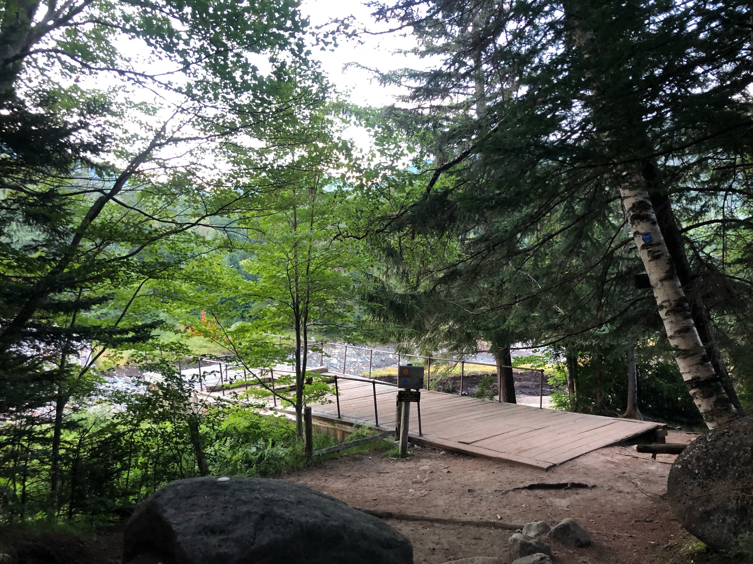
I was soon crossing the infamous wooden planks with the mountain in sight, passing numerous hikers on my way. After what felt like a long time climbing (and it was – 8.5 miles including Tabletop!) I summited this 5,344-foot beauty at 12:30PM. I was so excited to have made it by myself – among dozens and dozens of other hikers. There was a light breeze with otherwise perfect summer conditions. After a sock change, photos with my tripod, and food and water, it was time to carry on. Despite this significant achievement, I still had a long day ahead of me.


Mount Skylight: a moment of (necessary) panic
Next stop: Mount Skylight. I would get here by descending Marcy from the other side over Schofield Cobble. This provided magnificent open views, until the descent to the ‘Four Corners.’ This is a 4-way junction where Marcy/Skylight and Elk Lake trailheads meet. I continued straight to Skylight, where 0.5 miles would take me to another sprawling summit; however, this is where I realized something was off. I didn’t feel right – at all. I suddenly felt very dizzy and disoriented, and realized I hadn’t really been sweating. I was perhaps suffering from early stages of heat exhaustion, which immediately alarmed me as I was miles away from a trailhead. My body was telling me I was dehydrated and not eating enough, so I stopped right before the open summit. I took out my phone camera and saw how red my face was – not good. I remembered I had brought Salt Stick fast chews for an emergency, and knew it was time to try them. I took two chewables, drank whatever Gatorade I had left, and ate another snack. After a few moments of rest, I started to feel a little bit better – but nowhere near 100%. There were other hikers at the summit along with a summit steward, so I felt OK that if I needed help, I could get it. When I started to feel even better, I made my descent back to Four Corners, where I would now be taking a left to head towards my last peak of the day. But was this even a good idea in my condition?


Gray Peak & out: doubt vs. determination
While I was feeling better each passing minute from the electrolytes, I still debated if I should attempt Gray Peak, which is a herd path. After galivanting through lots and lots of mud, I approached Lake Tear of the Clouds – the source of the Hudson River. This section of trail was SO cool, especially since I had read about it – I wish I could have stayed to enjoy it. At the edge of the far side of the lake, I spotted the cairns on my right side to the unmarked trail to Gray. I decided I would do it – I made it this far, after all. I started my ascent, realizing this would be NO walk in the park – lots of rock navigating and rugged terrain stood between me and the summit (i read it is 0.3 miles to the summit, but somehow, it seemed SO much longer.) I passed a handful of hikers on their descent, making me feel better that I would hopefully soon be at my final summit of the day. Everything was going as best as it could, until I reached a vertical rock section, which I knew I could not manage to climb alone. But how did those other hikers just do this? There must be a way – what am I missing? Have I completely lost it?
I had to throw in the towel. I was losing way too much time contemplating a safe way up. I started to retrace my steps when suddenly, the way showed itself. The way around the rock had been there the whole time… That was it – this was my way around. I could continue my journey up Gray safely…I think I must have let out the biggest sigh of relief that I would not have to retreat down the herd path. I was going to make it after all. Soon enough, I reached the summit sign, snapped a quick selfie, and began my descent within that minute.
What goes up must come down…
While I had climbed all 4 peaks I had planned to, it was time to get back to the trailhead before the sunset. That was my goal. Little did I know, the most mentally and physically challenging part of the day still awaited me.
I made a right at the cairns and continued 1.1 miles on the Marcy trail until I reached the junction for the Lake Arnold trail, turning right to complete my loop. Smooth sailing, right? Not so fast; I thought I felt a drizzle of water, thinking it was strange since the weather had been so good all day. And then it happened as soon as I felt the first drop- pouring rain. Luckily, I had packed my rain coat, so threw it on quickly and kept moving. Soon after, I encountered the infamous “Floating Logs” section of the trail. The onset of rain had now made this almost impassable – whether nerves and anxiety set in, or just general fatigue from the day, I started crossing on the logs quickly, until I found myself suddenly submerged in the water up to my chest. And I had laughed at the people who said they fell in previously…and here I was, slipping and swimming through this section. I am for sure a strong swimmer, but fully clothed with a heavy pack on my back, the challenge was on. I fell in not once, but twice – and eventually swam my way across. Thankfully, my phone was zippered in the top pocket of my pack, remaining unharmed, but all my extra dry clothing and food were now soaked. Thankfully, it was a hot summer day, so the lil’ swim felt good – I did not feel sick or anything. But now, I was a soaked, exhausted hiker, trying to make her way back to the trailhead, with miles and miles to go. Alone. With no one cheering her on or giving her a hand.
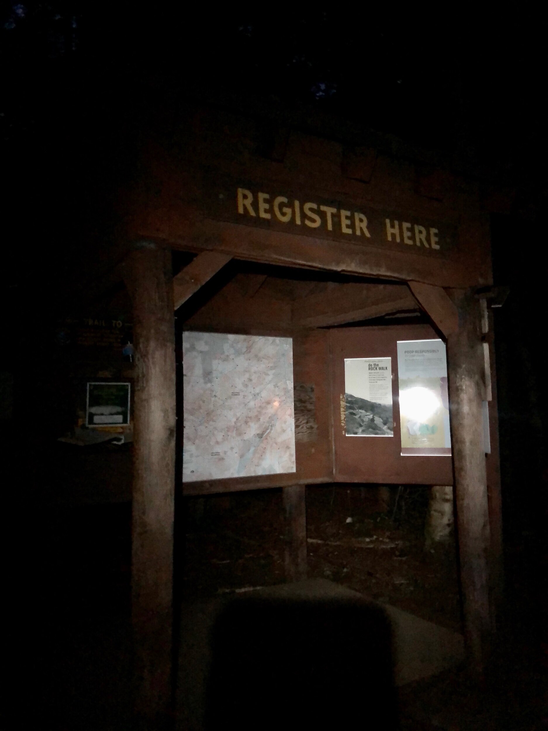
So, I did what I do best. I cried hysterically. I let it all out- it was just me and Mother Earth, her wrath testing me to my limits like no other. So we had a moment. But I also heard my phone buzz, and realized I had cell service once again. I texted my mother and boyfriend, letting them both know I was running later than expected from my hike. And I kept going. I sang. I drank whatever water I had left. And I kept dreaming of a hot shower and some food when this was all over. After what felt like forever (…it wasn’t) I reached the trail for Avalanche Pass, which would bring me back to Marcy Dam. I kept up the mental “pep talks” to myself and hiked onwards, as it would be dark soon. I was never so happy in my life to see Marcy Dam, but I was. I encountered a few other hikers and started my final push to the car. I would unfortunately not beat nightfall, so I had my headlamp ready for when it was time to switch it on. I could have sworn I heard a bear. A group of hikers werebehind me, so I tried to stay close to them – but they weren’t going fast enough. I was hungry and exhausted – so I started to jog. In my wet clothes, with my wet pack, and I never felt alive as I had in those 2 miles. And then I saw it – the trail register. It was over. It was time for whatever food I found at Stewart’s, a hot shower, and bed (see photo below.) Over 20 miles completed and endless elevation gain…I had just finished one of my most mentally and physically challenges in the ADK.
A few learnings… (but I gave you a lot to work with!)
Have a time buffer for the unknown – unexpected encounters, feeling ill, helping others, sudden weather changes, etc. Also, listen to your body; If you need to take a break, do so.
Be prepared to spend the night. This means extra layers, a bevvy, extra water (or filter) extra food, and so on.
Accept that it is OK to orphan (not hike) a peak – it is not OK to put your safety and health at risk for no reason. My ego got the best of me, when I really should have orphaned either Gray at the end, or Tabletop in the beginning. The mountains WILL be there for you next time, and it’s just another excuse to go back out there!
You build mental strength with practice. This is one of the toughest things for me. You must absolutely trust yourself, believe in yourself, and be your own cheerleader.
Hiking these peaks is a mental challenge as much as it is physical. If you want to do something, you will. But be patient and kind with yourself. Let go of perfection and accept that some days will be more challenging than others – you will come out stronger on the other end, I promise.
This won’t be the last time I write about a time when things didn’t go smoothly – this is just the beginning.
And yes, even after all of this, I love the high peaks wilderness more than I ever thought possible…along with Stewart’s Shops for consistently being there for me through all my low moments.
XOXO


