Catskills: Friday + Balsam Cap
September 2022 | near West Shokan, NY
Region: Slide Mountain Wilderness
The background: In my quest to hike all Catskill 3500’ers, there’s no way to avoid the more difficult bushwhacks without just going for it (with preparation and planning, of course!) I was a bit intimidated by these two particular hikes, since both were said to be complete bushwhacks the entire ascent. My two hiking partners were happy to come along, so we went for it on a September day, starting in the morning and ready for whatever the mountains had planned for us.
Spoiler alert: now having completed all 33 x 3500’ers, I can confidently say it was not the most difficult bushwhack in the park! Herd paths were mostly visible much of the way, and it turned out to be a fun (albeit, steep) day! It is still imperative to plan, do some research, and be comfortable navigating herd paths and uncertainty on the trail (along with bringing the usuals - extra water, food, and headlamps.)
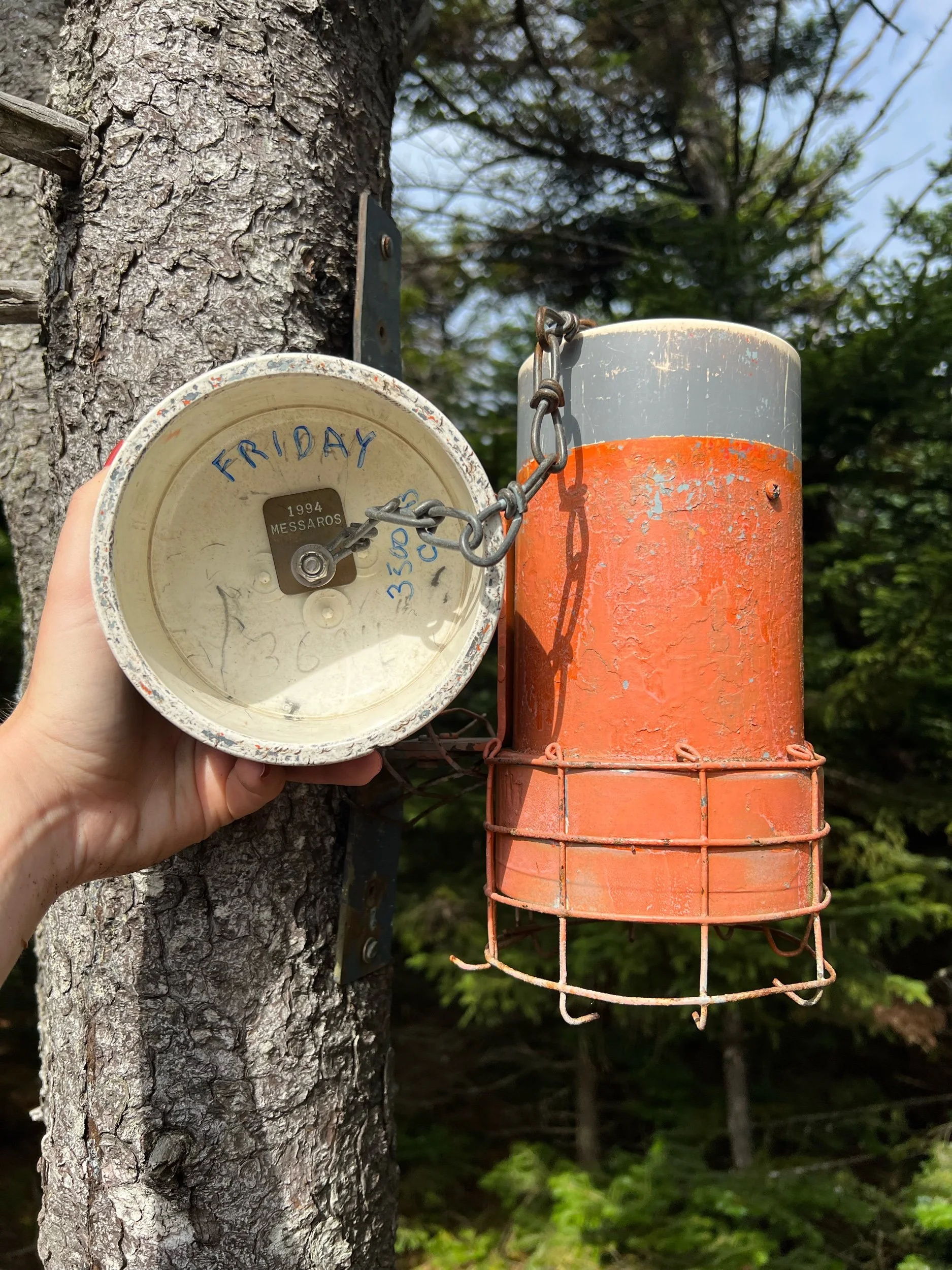
The hike: ~ 6.5 miles (10.46km) of herd paths/ bushwhack out-and-back to each summit. (Can be hiked one or the other, too, if you are short on time or energy.) Elevation gain approximately 2,700 feet (853m.) Limited views before each treed-in summit; both include orange canisters to sign-in. We hiked Friday first and then Balsam Cap after (but can also be done in reverse.) Many hikers tack these two on to 4 more Catskill 3500’ers, if you’re looking for a more challenging route and/or want to make a multi-day trip out of it.
Getting to the (unmarked) trailhead: You’ll be parking at Moon Haw Road. If coming from the thruway, take exit 19 for NY-28, driving for 16 miles. Then, turn left onto 28-A (if you see the school, you went slightly too far.) In 3 miles, turn right onto Watson Hollow Road. In less than a mile, you’ll make a right onto Moon Haw Road. Keep left to stay on Moon Haw Road for about 2 miles, until the end of the road. If you park on the right-hand side, the unmarked trail will start on your left.
Important notes: There is no official sign for the trail or a trail register, so don’t be alarmed when you don’t see either of these things. This is one of the more moderate to difficult bushwhacks you will encounter in the park (although not the hardest in my opinion) however, I found there to be herd paths most of the time. If something feels off to you, it probably is, but a map downloaded ahead of time can provide some guidance at times when you are truly unsure and be used as a backup. As always, share your route ahead of time with someone, as cell service will be sparse.


