Lyon Mountain (Fire Tower)
Region: Northeastern Adirondacks (Clinton County) Chazy Highlands Wild Forest
June 20, 2021 | Lyon Mountain, NY
The background: I fell in love with the fire tower trails ever since I set foot on my first tower trail, Hadley, in fall 2019. Fast-forward to summer 2021, and Lyon Mountain would happen to be my final tower to complete the Fire Tower challenge (technically speaking…see note below.) Not only do I enjoy the trails and summit views, but I truly love the history and seeing remnants of the cabins and structures. Each tower story is unique, and I always feel immersed in the history of prior decades when I’m exploring these trails.
You can learn more about the challenge here. To receive a patch of completion, you are required to hike 23 out of 30 towers – this also includes 5 in the Catskills (all 5 of those must be hiked.) So, that leaves you with completing (at minimum) 18 tower hikes in the Adirondack park (but you’ll want to explore them all!) You do not need to climb the tower structures for it to count for completion (and you’ll find some structures are no longer safe to do so!)
Now - let’s talk about this gorgeous hike – which also happens to be one of the tallest in the northeast section of the park!
Getting there: for reference, this is about an hour north from the village of Lake Placid –
From Lake Placid: head southeast on NY-86 for 12 miles. Continue on to Bonnieview Road for 6-miles and proceed to make a left onto Silver Lake Road for another 12 miles. Turn right onto NY-3 East/Water Street for 7.2 miles. Then, turn left onto Chazy Lake Road. Stay on this road for about 7.5 miles. Turn left onto Lowenberg Road, where the trailhead and parking lot awaits you a mile away.
(you can also enter “Lyon Mountain Fire Tower Trailhead” into Google maps and the address is accurate.)
Note: I am not sure how well-maintained, if at all, the last section of road is in winter. The last mile down Lowenberg Road is gravel, but your vehicle should make it to the trailhead just fine in 3-season weather (my front-wheel drive Jetta did fine.) You will most likely not have cell service.
The route: About 7.1 miles out-and-back via the Lyon Mountain Trail. Elevation gain: approximately 1,900 feet.
(Note: maps may show an “Old Lyon Mountain Trail” which is apparently shorter but steeper; I’m not sure how well this is still maintained. My recap describes the newer marked trail, which will be apparent when you are there so long as you follow the markers.)
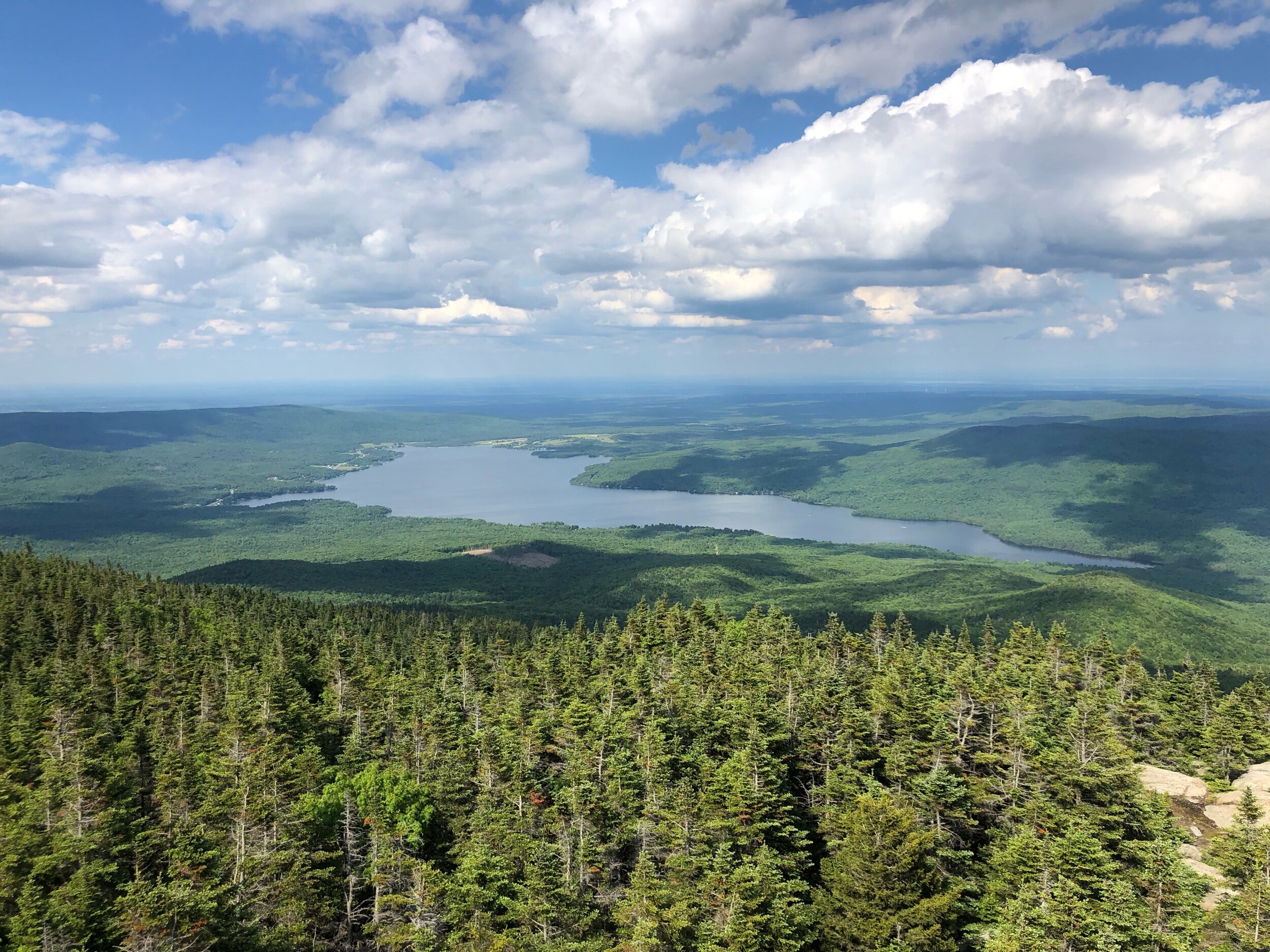
The hike: We arrived at the trailhead in the early afternoon, after coming from Elizabethtown and a quick stop to grab lunch. A few cars were parked, but it did not seem too busy – and the lot accommodates quite a few vehicles. It was a gorgeous Sunday in June, just at the turn of the summer season. We set off on the trail (left-hand side when you’re driving to the trailhead) and signed into the register, where we were greeted with a beautiful forest setting. For the next two miles, we hiked through this beautiful backdrop, only gently climbing at this point, through various switchbacks, a bridge, and some streams. After the two miles or so, you will start to really climb - after all, this IS a prettttty tall mountain by ADK standards (not quite a High Peak, but almost – 3,830 feet!)
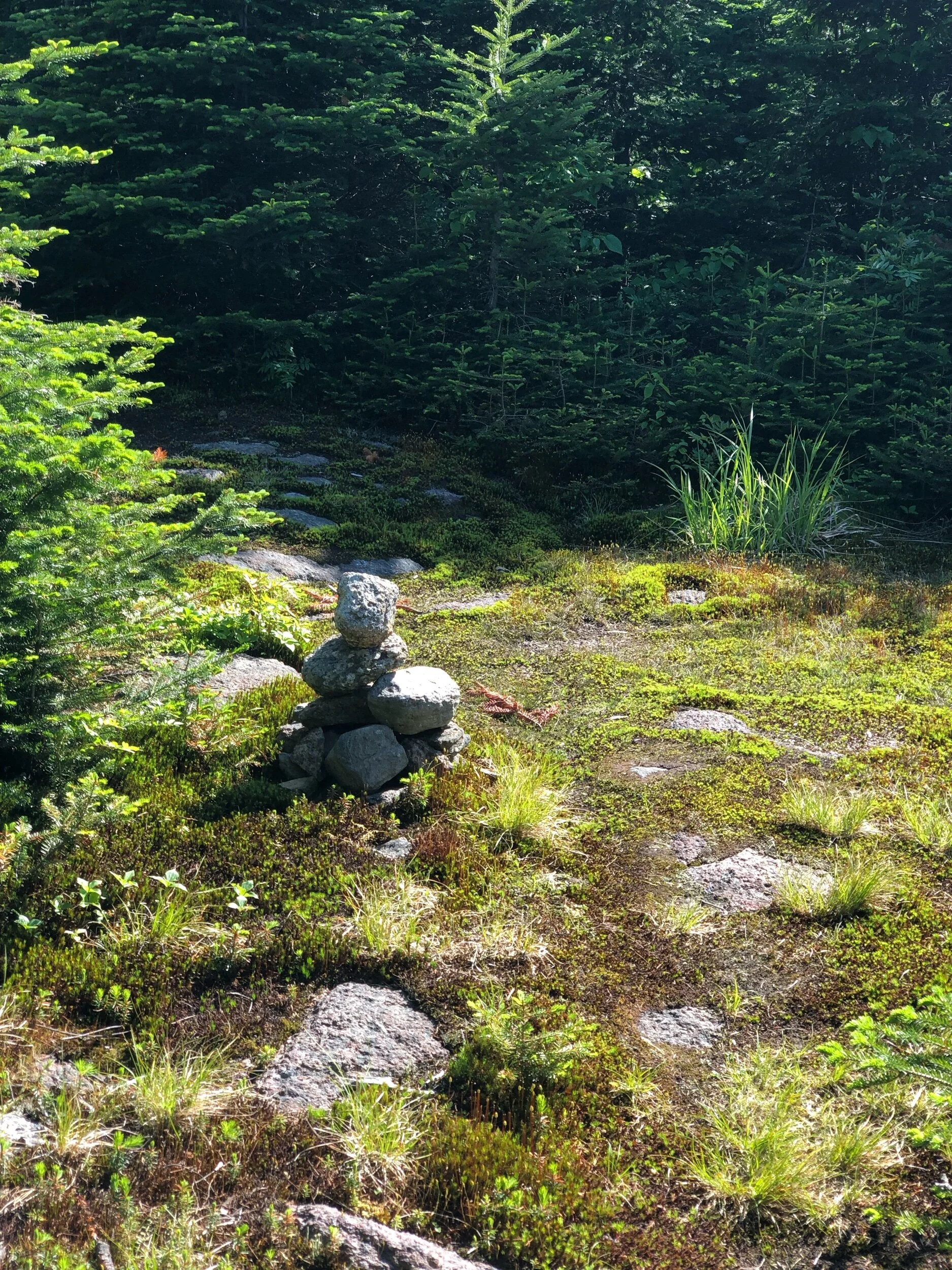
While no section is technical or complex, you will have to scramble a bit and will be working to get to that 360-degree view. You will also cross over the “Old Mountain Trail” at some point, and start to see views of Chazy Lake between the trees… getting closer! After some more bouts of climbing and switchbacks, you will see it – the open summit! And of course, the fire tower structure beaming proud and tall! At the time I visited, the cab at the top was open to soak in all of the views – from Quebec to the north, Vermont to the east, and the High Peaks to the south. We could not have chosen a better day to climb this mountain. Although the views are magnificent from the tower, you will also experience amazing views from just standing on the mountain itself. Once you’re at the tower, if you continue on, you will see a small, unmarked, but apparent, trail, which will lead you to another area on the summit, or the true summit (this section was muddy.) I started to venture out this way, and made it to the cairn, before deciding to turn back and spend my time enjoying my 18th Adirondacks Fire Tower. For the descent, we headed back the same way we came, this time, stopping at the stream to really embrace all that mother nature had for us on the trail. There is nothing quite like that first week of summer feeling. It was fantastic and reminded me of why I love hiking and exploring every place in the Adirondacks, no matter how far it might be for me to get there!
Concluding notes:
If you are like me and come from downstate and typically stay in Lake Placid or Lake George I would be lying if I said this hike wasn’t a bit out of the way. But I’m not lying when I say this hike IS incredible and totally worth the extra driving time, whether you’re chasing fire towers or not. Make some time to get here when you can – you will be happy you did. And I’m not sure how crowded it gets since it is farther away from the “major” destination towns in the park – so this could also be something to think about when you’re planning…
If I were to hike this again, or recommend a day of hiking to others, I would perhaps plan one of the below:
Add on Loon Lake Mountain Fire Tower, a shorter (mileage-wise) but straight-up “stair master steep” hike about 45 minutes west, if you are heading in that direction.
If you’re heading back towards the Wilmington or Lake Placid region, stop at Silver Lake Mountain (not a fire tower hike, just a generally nice, short, steep hike) which is on the way back into town heading south.